Skip to content
KALIX

Waymark

Live site · Canvas map

Open the live site

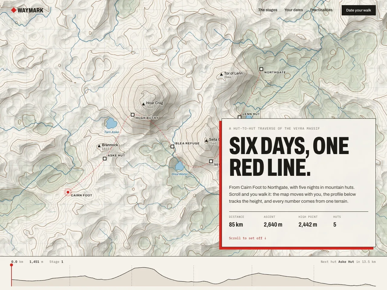
A hut-to-hut walk told as a survey map: scroll to walk the red line while the map, elevation profile and stage figures follow.

Works with
Lovable · Bolt · Cursor · Claude
Made by
Kalix

Live concept site · Canvas map

One synthetic terrain drives everything: the contour map, the relief, the route, the elevation profile and every distance, climb and walking time on the page.

Open the live site

What to try

  • Scroll-driven journey: the map pans and zooms to follow the walker through six stages
  • Elevation profile that can be dragged or keyboard-scrubbed; the page scrolls to match
  • Planner: start date, pace and an optional rest day produce a dated itinerary
  • Copy the itinerary, or download it as a real .ics calendar file

What the prompt gives you

  • A long-form build prompt written from the finished site, including the terrain function, marching-squares contours and scroll mapping
  • The relief pre-render script and the canvas renderer structure (Path2D contours, on-demand drawing)
  • Accessibility, performance and verification checklists used on the demo

Assets and dependencies

AssetHow to get itLicence
relief.webp (2000 × 1120 shaded relief with forest and rock)Generated from the terrain module by the included scriptOriginal work
Contours, streams, route, huts and profileComputed at runtime from the same terrain (streams from a drainage network)Original work
Archivo, IBM Plex Mononext/font/googleSIL Open Font License 1.1

Licences are listed as recorded by Kalix. Check them yourself before you ship a commercial project; this is not legal advice.

What you can change

  • Terrain seed, peaks and tarns
  • Route control points, hut names and where each night falls
  • Stage copy and the planner rules
  • Palette: paper, contour, route and water colours